Selenium is open Source Automation testing tool.SEO Adviser is consultant provide SEO ,SMO and PPC services, How to grow business on Google,Bing,Yahoo and other Search Engine.
Showing posts with label kedarkantha trek. Show all posts
Showing posts with label kedarkantha trek. Show all posts
But Sankri and this area it’s much more than a trekking base camp.
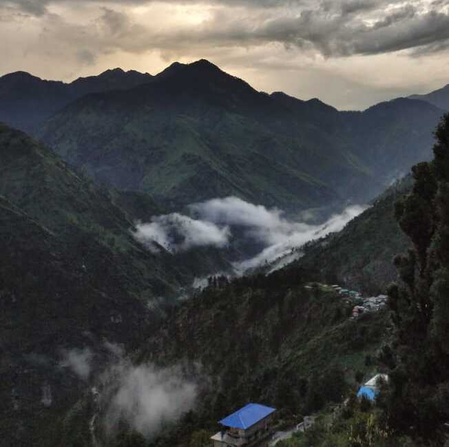
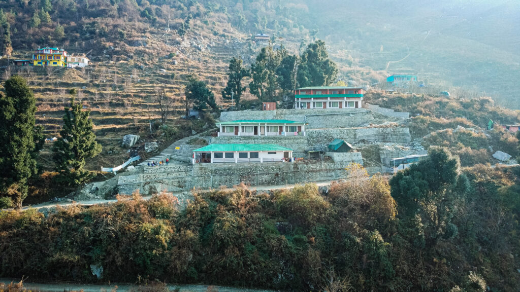
Sankri Village, Credit: Tina
If you like to stay in remote areas where the commercialization didn’t take much place, this place it’s an amazing place to spend some time, and interact with the locals, and explore around.
I’m a person who doesn’t like to be in commercial places, I like to be with locals and be part of the routine from the place.
This place has a strong energy, and a strong culture.
After coming to India for 12 years, I can say Sankri has been one of the most special places with a strong culture.
Views from Sankri, PC: Tina
Apple orchards, PC: Tina
I invite you to come, if you are this type of traveler who likes to be around locals and far from commercialization, Sankri is a perfect place to bring up your imagination and to learn from the pahadi culture, and immerse in a beautiful journey with the locals.
People are amazing here if you show respect and interest to be one more while you are here.
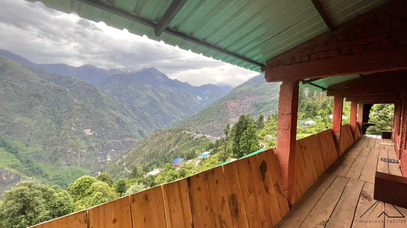
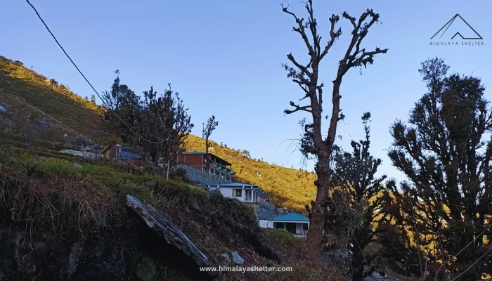
When I reached Sankri I stayed with one amazing family, then I changed to Himalaya Shelter, they provided me with the best homestay in Sankri, the rooms they provide are big, with amazing mattresses and incredible views.
Location it’s a bit uphill, so you don’t have the disturbance from the road, it’s a perfect place to retreat and to deepen yourself.
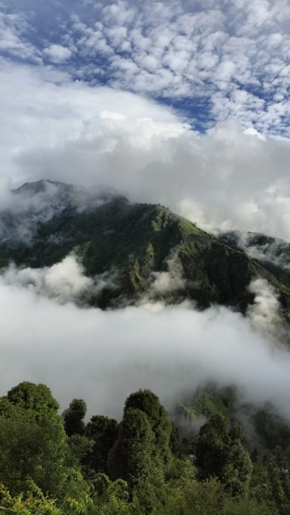
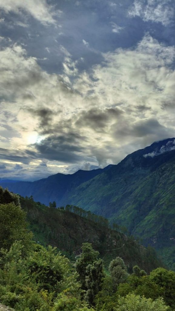
View of surroundings, Sankri
Rooms at Himalaya Shelter
Himalaya Shelter Guest House, Sankri
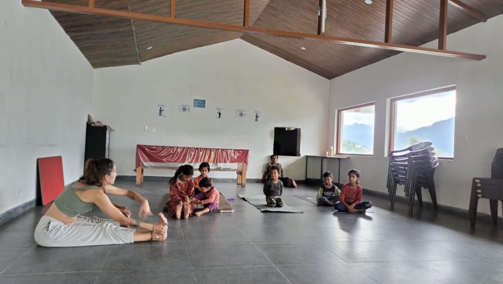
They have the best rooms available for a long term. You can come and get an experience of work from Mountains, and explore in your free time around Sankri. I had been lucky the kids from the village came here for the apple harvesting.
Himalaya Shelter is surrounded by apple orchards, some families move this time of the year, around here for harvesting, so I had been blessed to teach them yoga, and play with them, with the surprise they were interested in learning English. English is a problem in this region.
Practicing Yoga with children, Sankri, Credit: Tina
As a woman from Europe traveling alone, it has been an interesting journey, the confrontation sometimes, but I think this is part of traveling, to learn from each other and to accept our differences of culture but at the same time understanding we are all the same.
Himalaya Shelter provided me a room with food, amazing Sheff , we became family. Thank you for providing this quality rooms in this remote area.
I have great respect for the Pahadi women, they are the pillar of this society, and they work hard with a smile. They gained my admiration, thank you for bringing smiles into this society.
Sankri will be happy to welcome more real travelers, the ones who wanna learn and experience the local life! and, Himalaya Shelter it’s the perfect place to stay, no doubt about it.
Tina, from Spain
Contact Details:
Himalaya Shelter organizes customized trekking programs for Winter treks, Summer treks, Monsoon treks, High mountain passes treks, Glacier treks, Cultural Exploration treks, and many others. With Himalaya Shelter, you can expect to get the best trekking experience by trekking with trained trek leaders, getting excellent quality equipment, and enjoying delicious meals while savouring the beauty of Mother Nature. For more details Contact Us on…
Contact No: +91 9458386006
Email ID: info@himalayashelter.com
In Himalaya Shelter, we provide you with the option to customize your trekking experience. Whether you’re a solo traveller, a group of friends, or a family, you can opt for our personalized tailor-made trekking program. This customized trek will be exclusively designed for you, taking into account your specific requirements for transportation, accommodation, meals, and any other premium facilities you may need during the trek. No other participants will be added to your group. Choosing a customized trek will enable you to fully enjoy the trek with your loved ones.
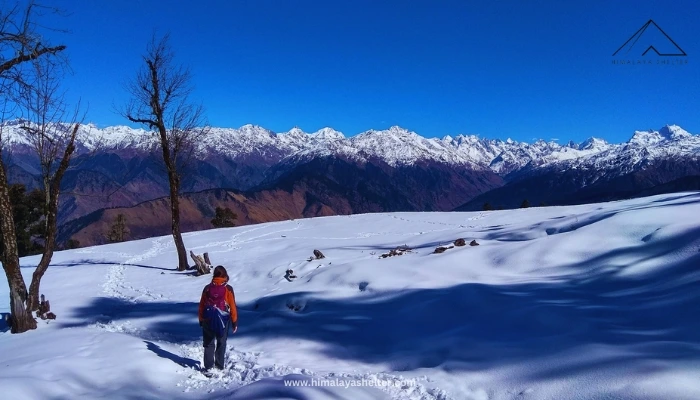
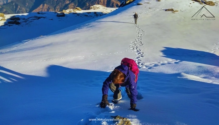
Kedarkantha Trekis located in the Sankri village of Uttarkashi district in Uttarakhand. It is a beginner-friendly trek and lasts up to 5-6 days. The trek begins from Sankri, taking you to the highest altitude of 12,000 ft at the Kedarkantha Summit. It takes 3 – 4 days to cover the distance of 20 km while following the hiking difficulty of moderate level.
The trek route ends at the same point at Sankri with a loop circuit. There are various starting points for the trek and starting from Sankri via Juda ka Talab is one of the most popular and easiest routes. The distance from Sankri to Kedarkantha trek is 10 km, and the total distance for the Kedarkantha trek to the summit and return is 20 km. However, starting from Gaichwan village and Kotgaon, the trek distances are a little bit different. These routes are less frequented and steeper as compared with the Sankri route, which we will discuss later in this blog.
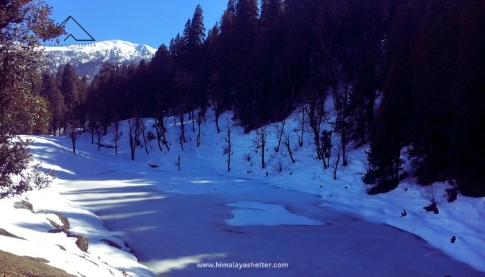
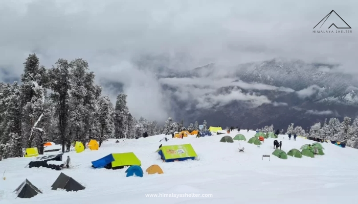
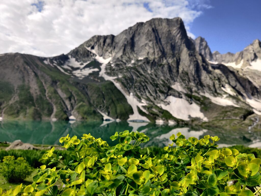
The routes are packed with mesmerizing views of the Himalayas and the beautiful lake of Juda Ka Talab, amazing campsites of Hargaon, Khujaai, and Bhoja Dhadi. The stunning clearings of Kedarkantha Basecamp, and many more attractions along the way.
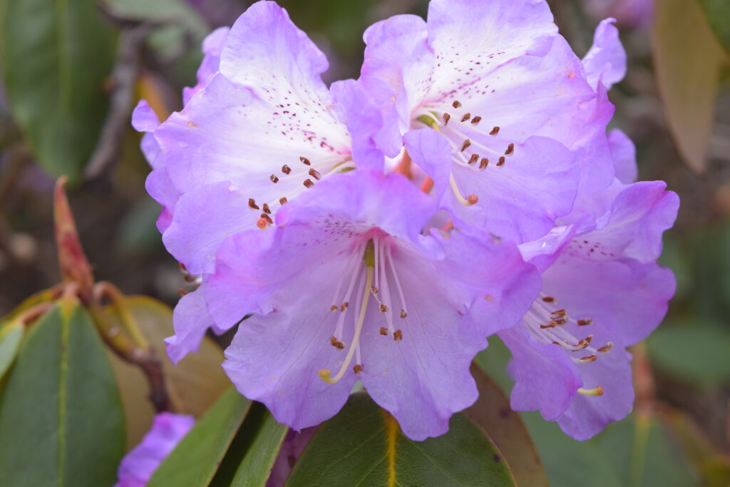
The trail lies within the Govind Wildlife Sanctuary, enriched with diverse flora and fauna. It is surrounded by dense forests of towering pine, rhododendrons, and deodar trees, which turn white during the winter, creating a heavenly snowscape.
Along this path, you will be able to spot the majestic views of Bandarpoonch, Black Peak (Kala Naag), the Gangotri Range, and Swargarohini.
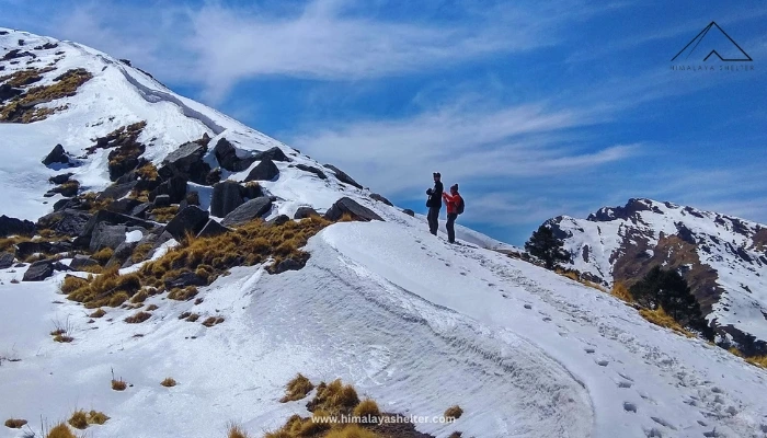
The trails are well-marked and have multiple exit points. So, you don’t have to worry about getting lost here. However, due to the steepness of the terrain, any false step can lead to a disaster. Hence, it is really important to walk carefully on the trail.
In this blog, we will provide insights into the altitude, distance, elevation, and trek routes available that you can choose for the Kedarkantha Trek, which can be helpful to get an overview of the physical fitness required for the trek, terrain sections, hiking difficulty of the trek and to understand the essence of precautions and skills for a Himalayan trek which vary accordingly to the height and distance of a trail.
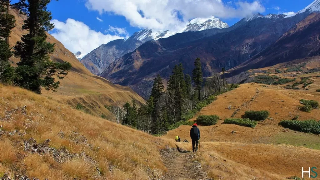
Reaching the Sankri base camp to start the climbing
The starting point of this trek is Dehradun; from here you will have to reach Sankri. If you are traveling from Delhi, you can reach Dehradun in multiple ways. The distance from Delhi to Sankri is 450 km, and from Dehradun, it is 210 km. You can travel from Delhi to Dehradun via the following ways:
By Bus: You can find multiple direct buses from Delhi to Dehradun from Kashmiri Gate, Delhi. The distance is about 265 km, and it will take you up to 7-8 hours to reach the location.
By Train: There are two overnight trains from Delhi to Dehradun: Nandadevi Express and Dehradun Express. It will take you about 6-7 hours to reach Dehradun by train.
By Flight: There are direct flights from Delhi to Dehradun, which will drop you at the location within one hour.
Once you reach Dehradun, you can simply hire a cab to Sankri. It is a drive from Dehradun covering a distance of approximately 200 km within 7 to 8 hrs. This drive will take almost the entire day to reach the Sankri, once you get there, book a homestay in Sankri or proceed with your Kedarkantha Trek package provider.
After entering the Sankri region, start the ascent to Kedarkantha Peak using any of the three major routes available for the Kedarkantha trek, as mentioned below:
The Sankri Route:
The altitude of Sankri is 6397 feet. You will start walking from this point and the path will pass through the dense forest, the lake of Juda ka Talab, and the small meadows of Kedarkantha Basecamp. Pine and oak trees mostly surround it. This route is most frequented and popular due to its easy accessibility, gradual ascents, and best views of surrounding the trail.
The first campsite is Juda Ka Talab on this route, which is located at an altitude of 9000 feet. It will take you 3-4 hours to reach the campsite and after completing the hiking to get there, you can enjoy the surroundings of the lake in the remaining time.
Kedarkantha Basecamp:
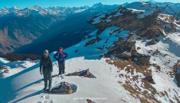
On the second day, you will start your journey to the Kedarkantha Basecamp which is located at an altitude of 11,250 ft. It is an approximately 3 km long trail that takes you up to 4-5 hours to reach here and this is the viewpoint where you will be able to spot the Swargarohini, Bandarpoonch, Ranglana, and Black Peak (Kala Nag).
Kedarkantha Summit:
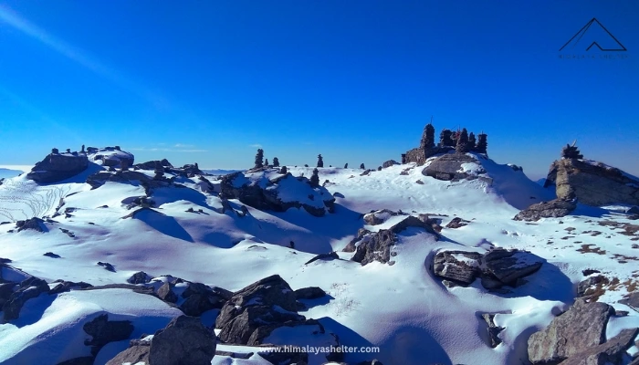
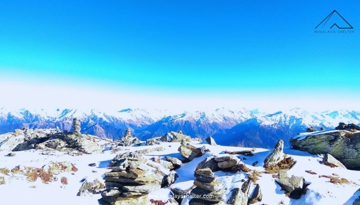
On day three, you will walk from Kedarkantha base to Summit. The third day is the hardest as you will have to walk at an altitude of 12500 feet. On the top of the peak you will find the majestic views of Rupin and other peaks. Along with this, there is also a shrine of Lord Ganesha and a small temple dedicated to Lord Shiva and Parvati.
Now, you will travel back to the juda ka talab and finally to the Sankri base camp.
The Kotgaon Route:
On this route, you will proceed forward via Kotgaon instead of Sankri. Kotgaon stands at an altitude of 6400 feet. The trek starts from Kotgaon to Khujaai and the distance for this hiking is approximately 5.3 km, reaching an altitude of 9,460 feet.
On the second day, you will walk from Khujaai to Bhoja Dhadi which takes you at the altitude of 10,700 feet. On third day, finally you will reach the summit of Kedarkantha.
The Kotgaon route follows the path mentioned below-
The Gaichwan Gaon situated 5,600 feet runs this route.
On the first day of the Gaichwan Trek route, you will reach the campsite of Julota (8,950 ft), and on the next day, the path continues towards the next campsite, Pukhrola (10,800 ft).
On the summit day of this trek, the route finally reaches the Kedarkantha Summit (12,500 ft), and then follows a descent to the previous campsite at Julota. The next day, the route concludes with a descending hike from Julota to Gaichwan village.
The Gaichwan Route follows the route as mentioned below-
Aslkjaw awver
So, which one route is the best for trekkers:
Among these trek routes to Kedarkantha Peak, the Sankri route is considered the best, and we mark it with stunning landscapes. It is a beautiful campsite where you can rest and gain energy for the rest of the journey.
The view from the top is worth all the wait. If you visit the snowcapped mountains during the winter, the experience will be breathtaking and the best decision of your life. So, grab your backpacking essentials and start preparing for the best winter trekking destination, Kedarkantha Trek.
Kedarkantha Trek stands at a height of 12,500 feet (3,810 meters) above sea level. The summit offers panoramic views of the majestic Himalayan peaks, including Swargarohini, Black Peka, and Bandarpunch.
Reaching at this highest altitude of the trek can cause altitude sickness which requires careful itinerary planning to reach such a high altitude of the peak. The best way to avoid this condition is to climb slowly and let your body adjust to the environment accordingly. This is why you should take at least 5 days to complete this trek and walk for only 3-4 km each day.
However, the altitude is ideal for beginners if it is planned to cover the entire trail within a minimum of 4 days.
“AMS, or acute mountain sickness, is a condition that occurs when you travel to high-altitude places, i.e., above 8000 feet. It happens in the low oxygen zone where the air pressure is low, and it starts affecting your body.”
Overview on Guide to Kedarkantha Trek Distance
The total trek distance of the Kedarkantha Trek depends on the trekking route followed. If climbing for the route proceeds with the Sankri route (mentioned in detail in the above section) then from the Sankri village (1,950 meters) to Kedarkantha Summit the trail covers a total distance of about 10 kilometers (6.2 miles) away. You can complete the trek route from Sankri to Kedarkantha Summit and back in 4 to 6 days. Number of duration for completing the trek route, depends on the fitness level of the trekkers, whether you are a beginner or experienced trekker.
The trail passes gradually through some of the key spots such as Juda ka Talab, Kedarkantha Base Camp, and Kedarkatha Summit with the distance and elevation gain as mentioned below-
From Sankri-Juda ka Talab – Kedarkantha Base Camp (3,429 meters),
Proceeding toward the summit from the Kedarkantha Basecamp, it involves a steep climb with an elevation gain of 1,250 feet (381 meters) and covers ascent with a 3 km long trail.
The most importantly, this is the only section on the entire trek route that can really test your physical and mental strength, also is the biggest factor that puts the trail of Kedarkantha into a moderately challenging category.
Physical fitness as per the overview on altitude, distance, and trek route of the Guide to Kedarkantha Trek
So, after reviewing some aspects of altitude, distance and trek route. it is understood that the Kedarkantha is a beginner-friendly trek but you must remember a few things before climbing. It is definitely not recommended for people who have asthma or breathing problems.
Moreover, even if you are healthy, have no such ongoing diseasein on your body, you can start preparing yourself at least a month before the trek.
How can you be sure if you are fit for this trek? Typically, if you are capable of running for at least 5 km daily within 30 minutes.
Always bear in mind that the higher level of physical fitness you have, the higher level of vibes you can feel, and you get some never-lasting memories of smilies, and deep connection with mother nature with no single shot of frustrated mind, and a face distorted by exhaustion.
~Shivam Chand
If you can’t finish 5 km run in 30 minutes, work on building up your strength. To climb the Kedarkantha Peak within that time frame yourself.
Start running with 2 km running distance covering within 15 minutes and reduce the timing day by day. Try this for a week and then increase the running distance to 3 km and follow the same procedure again.
Walk for at least 4 or 5 km daily with some weighted bags to build endurance for long-distance trail.
Practice some breathing exercises to train your lungs for high altitude. Additionally, you should learn more about how to prepare yourself for a Himalayan Trek.
Conclusions:
This blog has provided you with valuable information about the altitude, distance, and different trekking routes for the Kedarkantha Trek. If you find any suggestions for improvement or important points missed in the comment section, please share them.
Contact Details:
Himalaya Shelter organizes customized trekking programs for Winter treks, Summer treks, Monsoon treks, High mountain passes treks, Glacier treks, Cultural Exploration treks, and many others. With Himalaya Shelter, you can expect to get the best trekking experience by trekking with trained trek leaders, getting excellent quality equipment, and enjoying delicious meals while savouring the beauty of Mother Nature. For more details Contact Us on…
Contact No: +91 9458386006
Email ID: info@himalayashelter.com
In Himalaya Shelter, we provide you with the option to customize your trekking experience. Whether you’re a solo traveller, a group of friends, or a family, you can opt for our personalized tailor-made trekking program. This customized trek will be exclusively designed for you, taking into account your specific requirements for transportation, accommodation, meals, and any other premium facilities you may need during the trek. No other participants will be added to your group. Choosing a customized trek will enable you to fully enjoy the trek with your loved ones.
As I am writing this blog post, the Uttarakhand government has opened up inter-state and inter-district travel post lockdown with certain terms and conditions. It has also lifted all restrictions for international travellers. The impulse to travel, to explore has been brewing for a while since we all got locked up indoors. The tour operators, hotels, homestays, transportation sector are slowly gearing up for the new normal. The actual act of going places though will depend on many criteria including the season in which you would end up feeling comfortable traveling again.
Worry not! The state of Uttarakhand is that perfect destination which fits the bill, come rain or shine. Nearly tropical in the foothills and tundra above the snow line, it rationalizes the call to go on day hikes or multi day treks all year-round. The “Land of Gods” is blessed with five distinct seasons. This offers an opportunity to travel to various locations or return to the same locale to experience it in a totally different setting.
“Spring passes and one remembers one’s innocence. Summer passes and one remembers one’s exuberance. Autumn passes and one remembers one’s reverence. Winter passes and one remembers one’s perseverance.”
Let me build on what Yoko Ono once said.
SPRING
‘Vasant Ritu’, the season of innocent young love, rebirth and regrowth. Beginning of March to mid-April, the snow starts receding and it gives way to pleasant weather resulting in new leaf growth and flowers begin to bloom. Apple blossoms paint a delicate picture which would leave you absolutely spell bounded.
This is the time to wake up early at the campsites to enjoy the dawn chorus. Songbirds regale us all with their melodious renditions. Look out for Himalayan woodpecker, Verditer Flycatcher, Warbler varieties, Tree Creeper, Black Bulbul, Black Bird, Blue Whistling Thrush, Rufous Sibia, Russet Sparrow and the likes. It’s a birders paradise. The melting snow drives the gushing streams where you can watch the Plumbeous Redstart dive in for food in the freezing cold waters.
This is also the season of Rhododendrons or ‘Burans’. There are 6 species of this stunning flower in the state. Deoriatal-Chopta-Chandrashila, an easy beginner’s trek, is your best bet to enjoy snow-capped mountain scape with rhododendron laden trees and abundant bird activity.
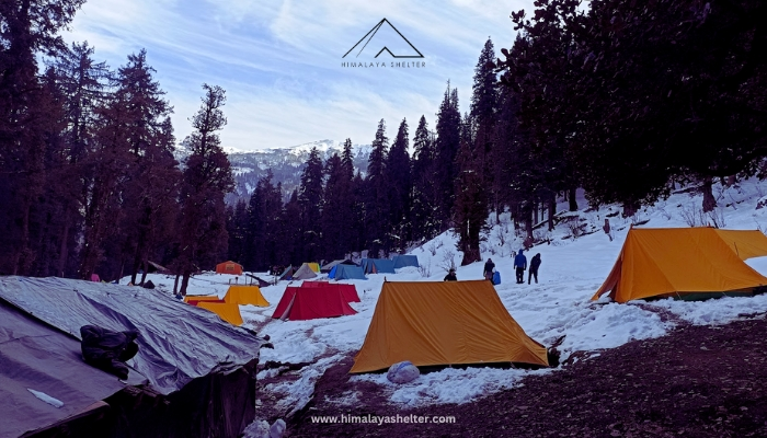
The treks that climb to over 3,000 m would still have good amount of snow to experience the nature of winter trek. The lower campsites start blossoming making it a very pleasing experience. The usual suspects, the winter treks of Kedarkantha, Nag Tibba, Dayara Bugyal and Mukta Top offer what is best of both worlds.
SUMMER
From mid-April or so, is when the higher altitudes buried deep in snow start becoming accessible. The Char Dham yatra commencing usually signals the opening up of passes. The trekking opportunities are aplenty till mid-June. Expect carpets of alpine meadows with the Gujjar community migrating back with their livestock to higher grazing grounds from the Shivalik foothills which are their home for winter. It is incredibly picturesque and you are bound to dance to “The Sound of Music”.
In my opinion, these are the months to test your endurance and take the big leap. The extreme adventurers say ‘summer bodies are made in winter’. If you have put in the effort to prepare yourself physically and mentally, there is nothing like a crossover trek. The passes crossing over from the state of Uttarakhand to Himachal Pradesh or vice versa like Rupin Pass, Borasu Pass and the less explored Lamkhaga Pass should be high on your wish list. These are also most favoured for the Garhwali and Kinnauri experience they offer.
In addition, there are treks which traverse from one river valley to another within the state. Namely, Bali Pass, a crossover from Tons river valley to Yamuna i.e. Har ki Dun valley to Yamunotri. On offbeat trek like Mayali Pass, which connects Bhagirathi valley to Mandakini valley, witness three alpine lakes and breath-taking views of the Gangotri glacier from the southern side.Dhumdar Kandi is another treacherous trek crossing over from Tons valley to Bhagirathi valley.
If you are all geared up for expedition level trek with basic knowledge of mountaineering, head to the challenging Kalindi Khal. Climbing up to almost 6000 m, it connects the two sacred Dhams of Badrinath and Gangotri.
Treks providing similar challenges include Panpatia col, a crossover from Kedarnath to Badrinath, and Auden’s col which connects Gangotri to Kedarnath.
MONSOON
July marks the beginning of neon green panoramas all around. The incessant downpour makes most of the trails muddy and slippery till the shoulder month of September. Also, landslides become a common occurrence resulting in roadblocks. So, it is advisable to always have a buffer day planned in your itinerary. This is the time when the treks in Chamoli district come alive.
Valley of Flowers, a popular moderate trek in Bhyundar valley is the most obvious choice to explore the vast expanses of alpine flower meadows. In conjunction you also get an opportunity to hike up to Gurudwara Hemkund Sahib, the highest in the world at 4,300 m. Keep an eye out for Blue Poppy and Brahma Kamal, the pièce de résistance of all the flowers you would come across in the region.
If you wish to travel off the beaten track, head to the emerald green Kagbhushandi Tal, a moderate-difficult offshoot trek climbing up from Bhyundar village providing prominent views of Hathi Parbat.
Head beyond the valley for the difficult crossover of Bhyundar Khal. The highlight of the trek for me would be negotiating moraines and glaciers like Rataban and Tipra.
Kunth Khal is another challenging offshoot trek from Valley of Flowers which only opened again recently in 2016. The walk amongst Brahma Kamal flowers as far as the eyes can see is an unparalleled experience in itself.
From the holy town of Badrinath and the “last village of India” Mana, is a moderate trek to Sathopanth Tal. You trek alongside river Alaknanda to this glacial lake at 4,400m. Here Nilkantha and Balakun peaks give company throughout the trek along with numerous waterfalls.
AUTUMN
Come October and the weather becomes crisp and the cloudless skies offer spectacularly clear mountain views. The monsoon shades of green fade away only to give way to dazzling warm shades of amber. The leaves turn golden, lighting up the forest canopy. These also are the best times to do milky way photography. So, this is the season you bring out the big guns, I mean you should head for the big views.
If you are up for the challenge, the trek up to the glacial lake of Kedar Tal in my opinion is the most rewarding one in the autumn month. Feast your eyes to uninterrupted views of Mt. Thalaysagar, Mt. Bhrigupanth and Mt. Jogin. It is a humbling experience to find yourself surrounded with this immensity. The trail will keep your adrenaline pumping with some tricky sections.
Another trek which ticks all the boxes is Gaumukh-Tapovan. Starting from the holy town of Gangotri it is a huge opportunity to be in the close vicinity of the holiest and mightiest of glaciers of India. The Tapovan meadow brings you to your feet with grand Mt.Shivling standing up in front of you. Also, on the trail enjoy impressive views of Bhagirathi I, II and III.
If you are someone who has the fundamental knowledge of mountaineering, Gupt Khal “the secret pass” is a challenging trek that crosses over the twin passes of Bhyundar Khal and Gupt Khal. The trek also offers close and glorious views of Nilkantha, Hathi, Nilgiri, Rataban, Kamet and Mana peaks.
Har ki Dun-Ruinsara Talis a trek steeped with culture. On one hand it offers the big views like Mt. Swargarohini and Jaundhar Glacier and on other are these ancient remote villages of Osla, Gangad and Datmir and then add to this mix a high-altitude lake. It is a well-rounded experience. The terrain on the trek is ever changing keeping you alert and guessing. The trek is like a pilgrimage to the mountains as the distances that you cover are substantial. Prepare yourself for long days on this trek.
Also, let me add that all the spring-summer treks are doable in this precious autumn window and vice versa.
WINTER
It’s the season for building snowman, snowball fights, making snow angels and layering up. Mid Dec onwards mother nature casts fairy dust turning everything monochromatic. Western disturbances bring heavy rain and snow in the region from Jan to Feb. Trekking in these months is possibly the most challenging but fun filled.
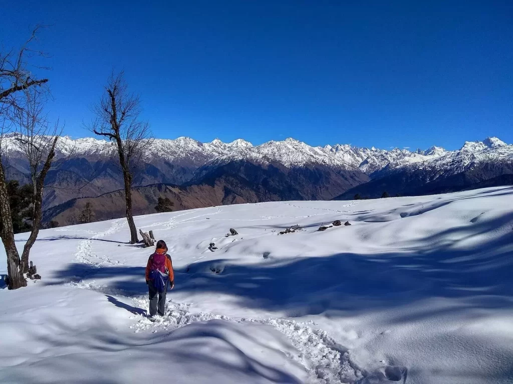
Kedarkantha, is possibly the most sought-after trail to trek in the winters in India and why not. The summit climb is rewarded with panoramic views of Mt. Swargarohini, Mt. Bandarpunch, Black peak, Ranglana along with Yamunotri and Gangotri ranges. On summit day the early morning sun rays warm your soul as the views warm your heart. This trek is located in the confines of a national park. During extreme snowfall, always be prepared for the trek to be cut short for safety reasons. Also, the forest authority closes down the park quite often, abruptly ending the season.
Kuari Passtrek the formerly known as Lord Curzon’s Trail, is most known for offering some unmatched views of Mt. Nanda Devi, Mt. Dunagiri, Mt. Chaukhamba, Mt. Nilkantha, Mt. Hathi-Ghodi, Mt. Nanda Ghunti and more. At 3,820 m the pass is a moderate effort for a prepared trekker. Furthermore, climbing up to Pangarchulla peak adds an exciting element to the trek. Enchanting forest sections and high-altitude villages on the way make this a complete experience in my opinion.
Nag Tibba, a ridge peak located towards the north-east of tourist town of Mussoorie, also offers 360° superlative views of the big mountains like Mt. Bandarpunch, Mt. Swargarohini, Mt. Srikantha along with the rest of the Gangotri mountain range.
The Windows wallpaper meadows of Dayara Bugyal turn pristine white during winters. The undulating snow-covered meadows are an ideal place to ski in the winters or be lost in the sea of white. Gangotri range of mountains are your constant companion on all the campsites and the summit day is a close encounter with Mt. Bandarpunch.
Treks like Dayara Bugyal, Nag Tibba, Deoriatal-Chopta-Chandrashila, Kedarkantha and Kuari Pass can be done throughout the year avoiding the peak rainy season. Each season brings different set of hues to the landscapes.
I hope now you can make an informed decision on the trek you would embark on in the Uttarakhand region when the pandemic curve flattens and travel becomes safe. Until then I encourage you to keep up with your workout routine. In fact, take this as an opportunity to get better with you mental and physical fitness which would make your experience in the mountains more enjoyable.